The universe that my ‘Ration Market’ builds is being extended into a special edition of the project called ‘Ration Market Special’. The title itself is a reference to and follows the grammatical logic of the Vietnamese and Cantonese word ‘dac biet/特別’, meaning ‘special’.
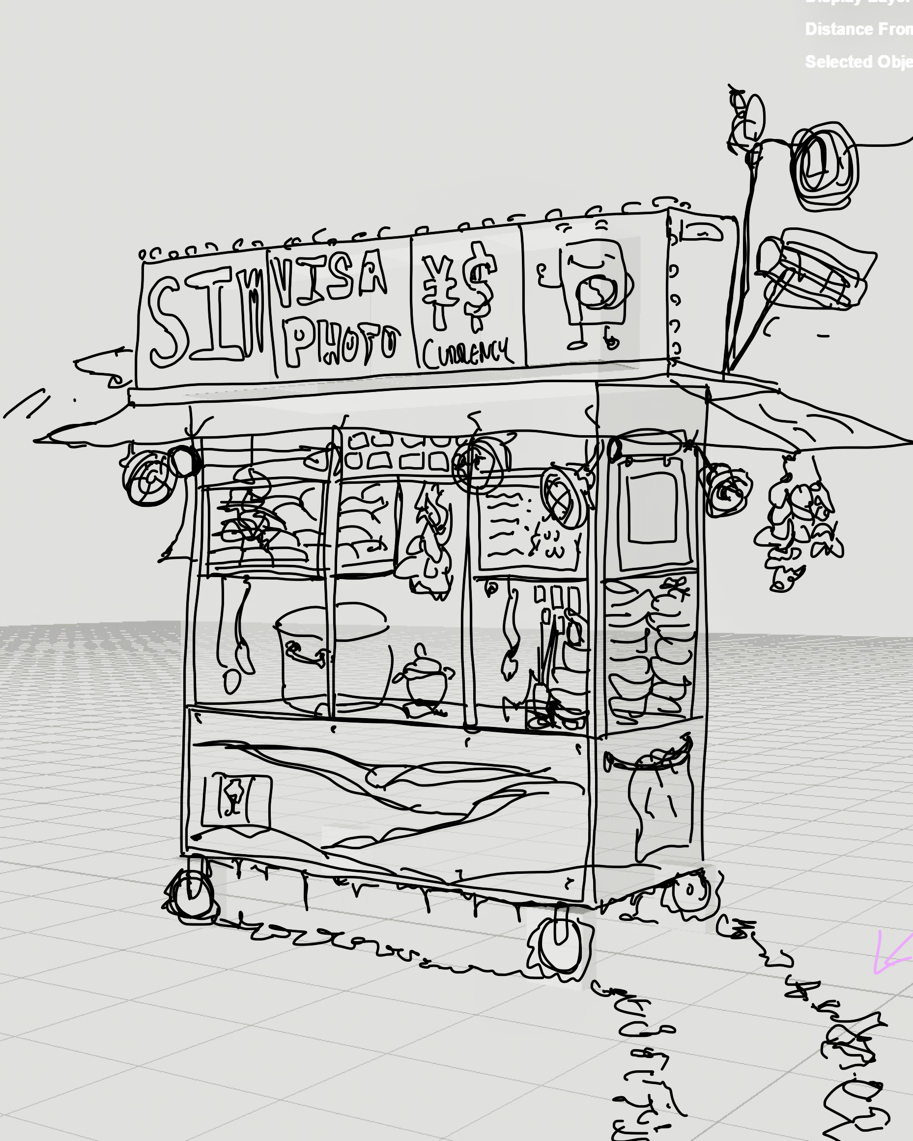
The ‘Ration Market’ will be expanded into a food cart that sells the river spinach rations as a prepared meal consisting of a rice porridge with a topping of reconstituted river spinach with a texture similar to spinach in a saag paneer. This food cart will also sell sim cards for different cellphone carriers in Asia Pacific, advertise a currency exchange service for currencies from Asia Pacific, as well as a makeshift booth for producing headshots for visa applications. Overall, ‘Ration Market Special’ is meant to paint a picture of a precarious station providing a quick meal and low-end services for people trying to flee Vietnam, a region that will soon face growing migratory pressures from Sea Level Rise (more of that below). The picture of migration that this artwork builds is not one for the upwardly mobile, who can migrate through official channels and high-end means of travel through flights, but rather one of the working class who may have to seek grey-market goods and human smuggling services to move across borders. It is a picture of low-end globalization in an era climate crisis.
The organization Climate Central provides a very intuitive and easy to comprehend visualization of the current climate models agreed upon by scientists and researchers in the field. Below are visualizations that reference the latest models from IPC2021. We can observe that Vietnam faces tremendous migratory pressures as its largest cities, Hanoi, the political centre in the north of Vietnam, and Ho Chi Minh City, the economic centre in the south of Vietnam, will both be effectively underwater when taking into account Sea Level Rise and the annual floods during the monsoon season. The areas around these sprawling metropolises which include small villages and towns will also be affected. The areas in red are regions that are below the projected flood level by 2050.

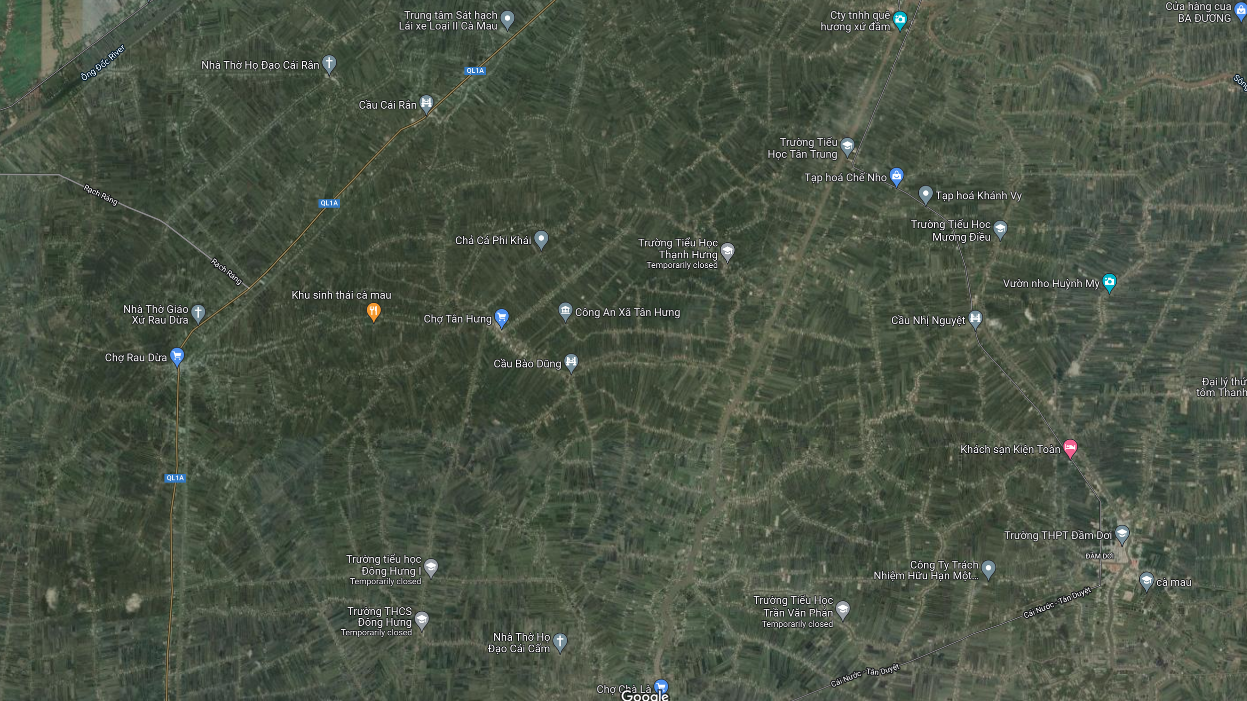
More relevant to my personal concerns is the Ho Chi Minh City area and regions to the south of HCMC. Below we can observe how Ho Chi Minh City’s historic quarters, Saigon and most of Cholon, are surrounded by a ring of flooding. Moving out, we can see the entire southern tip of Vietnam is effectively below projected flood levels. This also includes Cần Thơ, a historically important hub where Cantonese diaspora live, and where my grandmother moved to flee from the Japanese invasion of China during WW2. This area also includes Phuong Phu, the land that my video ‘Hole Story’ is about.


Aside from the loss of habitable areas and great cities, another great tragedy comes from the loss of effective agricultural land. When observing satellite images of regions around and south of HCMC, we can see that the land is densely packed with agricultural projects. Below we can see the agricultural lands near the vicinity of HCMC, and then the whole area south of HCMC. A myriad of green polygons can be observed in these satellite images dedicated to farming.

Lastly, we have a simulated fly-over of the southern tip of Vietnam around Ca Mau. In the video there is a simulated rain storm, and the whirring sounds come from the fans of an Nvidia RTX 3090 at full power. The GPU computing a storm sounds like a storm….